
Walk a Waipahu Street Record
A useful street-by-street result is a chain of dated records, not a list of people. Write the address just as it appears, including number, direction, suffix, unit, postal city, and ZIP. Waipahu sources may instead say Waikele, Waipio, Honolulu, Ewa, or use a plantation label. Change one part at a time when a search fails. That keeps a spelling fix from becoming an unsupported address change.
- Search Honolulu RPAD/qPublic. Save the TMK, owner field, situs, and mailing address separately.
- Open HOLIS. Match the tax parcel, regulatory parcel, address ID, and street shape.
- Carry the TMK into the Bureau of Conveyances index. Follow the current grantee to the prior grantor.
- Check HNL Build by TMK, then request the full permit file if needed.
- For past names, use a 1908-forward directory street index and inspect nearby years.
- Use the 2012 Street Index only as a dated district and ZIP crosswalk.
This method distinguishes an owner, deed party, permit applicant, and printed subscriber. None automatically equals a current occupant. It also makes a Waipahu street directory search reproducible because another researcher can repeat the address, TMK, source order, and dates.
Search Waipahu Streets in qPublic
The Honolulu qPublic property search is the best first stop for a modern address. The official landing confirms site-address, TMK, scheduled-appeal, and map modes. The current public landing did not confirm owner-name search, so do not assume that function. Search by address or TMK, then treat the returned owner as an assessment field.
| Search control | Use | Save |
|---|---|---|
| Street Number | Start an address search | Exact digits |
| Street Name | Match the road | Spelling variants |
| Direction and Unit | Narrow the site | Separate values |
| Site Address | Find the parcel | Situs label and ZIP |
| TMK | Open a known parcel | Parcel number |
| Owner Name | Result/detail field | Not a confirmed input |
Details can include land and building facts, assessments, taxes, sales, and instrument references. Some show living area, exemptions, bedrooms, or bathrooms. Fields vary by parcel. RPAD warns that the data serves assessment purposes and is not legal title.
The official Honolulu assessment search screen shows the starting point used for a Waipahu by-address search.
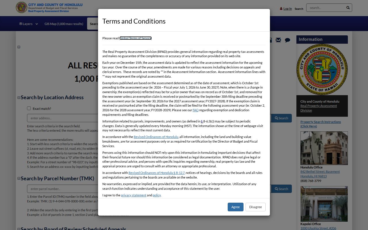
Read the disclaimer before searching, keep the parcel result date, and copy the TMK exactly. That key is more stable than a person name and can be carried into HOLIS, DPP, and the Bureau of Conveyances. If the screen does not return a match, remove the unit or direction one field at a time. Do not replace the site address with the owner mailing address merely to force a result. The two fields have different meanings and can point to different places.
Read Waipahu Parcel Clues
A parcel card can connect a Waipahu address to an owner name, land description, sales, and deed number. Save the TMK first. It is the crosswalk between assessor records, maps, permits, and deeds. Then record the site address, owner field, separate mailing address, sale date, instrument number, and assessment year. Condominiums, common elements, road lots, trusts, and utility strips may not resemble normal house results.
- Parcel
- A mapped unit of land used in tax or legal records.
- Situs address
- The physical property address, which may differ from the owner mailing address.
- Plat
- A recorded map showing lots, boundaries, roads, or a subdivision.
- Criss-cross directory
- A directory arranged by street and house number instead of only by surname.
Honolulu tax records may disclose an owner mailing address under OIP Opinion 11-01. It is a tax clue, not proof of residence. A home exemption also does not identify all household members. Keep ownership and occupancy in separate notes.
Note: qPublic says assessment data generally updates Monday morning, so save the retrieval date with each Waipahu parcel result.
Map Waipahu Streets with HOLIS
The HNL Reg Parcel Selector labels current tax parcel, current regulatory parcel, current address ID, and current address label. Search the subject address or TMK, select its polygon, and inspect parcels along the road. Save map date, layer, subject TMK, and adjacent TMKs. The HOLIS portal and open-data catalog provide the wider GIS route.
Tax and regulatory parcels can differ. A corner touch is not a shared street edge. Record road lots, drainage land, common elements, and vacant polygons rather than omitting them. State metadata describes Oʻahu parcels as of June 3, 2025, while HOLIS is maintained daily. The layers are visual references, not surveys.
This map pass turns one address into a sound street crosswalk. It does not prove relationships or identify unseen residents. For only the immediate block, the Waipahu neighbor lookup narrows the same parcel method.
Waipahu Records Indexed by Address
No official source is a complete household roll. A reliable street directory separates the evidence and explains every access route. RPAD has online and office access. BOC has an account, reference room, and mail requests. DPP uses HNL Build, its Data Access Imaging Branch, and records requests. Archives, UH, and libraries hold old directories and maps.
| Source | Keeper | Street facts | Limit |
|---|---|---|---|
| Assessment | Honolulu RPAD | TMK, owner, situs, mailing, sales | Not title or occupancy proof |
| Parcel map | HOLIS | Tax/regulatory parcels, labels | Not a survey |
| Land instruments | State BOC | Grantor, grantee, deed date, TCT | Online from 1976 |
| Permits | Honolulu DPP | TMK, project, review, dates | Old files by request |
| Printed directories | Archives and libraries | Name, street, work, phone | Uneven years |
| Street Index | Neighborhood Commission | House range, district, area, ZIP | 2012 snapshot |
When a portal fails, use the same ID at the counter or in a narrow written request. Hawaiʻi UIPA supports access to maintained public records, but does not force an agency to create a new street-wide compilation.
Carry Waipahu TMKs into BOC
Hawaiʻi has a statewide recorder. The BOC Data Search accepts grantor, grantee, TMK, Transfer Certificate of Title, document number, and recording date. Registration is required. Searching is free after registration, while images are paid. Read each image because an instrument code may mean deed, mortgage, release, lien, or correction.
Online index and image coverage begins in 1976. Earlier Waipahu deeds move to the reference room at 1151 Punchbowl Street, Room 123, or a written request sent to P.O. Box 2867, Honolulu, HI 96803. A useful request includes grantor and grantee, document number or Book/Page, type, contact details, certified-copy choice, payment, and a stamped return envelope. Verify fees before sending.
BOC reports processing more than 344,000 Regular System and Land Court documents and maps per year. Exact identifiers matter. Start with the current grantee, open the transfer, then search the prior grantor. Keep mortgages and liens in the timeline, but do not call them transfers.
Follow Waipahu Permit Files
Honolulu DPP connects permits to an application number, permit number, or TMK. HNL Build can show status, staff, approvals, plan reviews, dates, and tasks. A missing online result does not prove that no file exists. Historic Hawaiʻi’s house-history guide says permits before January 1972 are not online.
Use the DPP records guidance to reach the Data Access Imaging Branch or Request to View Records process. Name the TMK, address, application or permit number, date range, and desired plan or inspection record. UIPA is a fallback for a specific maintained record. Plans can date physical work, not occupancy.
Note: Preserve both the permit address and current RPAD situs when they differ; a remodel date does not silently correct an old address.
Browse Older Waipahu Streets
From 1908, Honolulu directories often have a street index leading from a house number to an alphabetical entry. Search the printed street, note nearby house numbers, then turn to the named line and photograph the abbreviation key. Compare two or three years. Before 1907, begin with a person, firm, mill, church, or camp and work toward the address.
The 2012 Neighborhood Commission Street Index records street and house ranges with district, subdistrict, area, and ZIP. It is a dated geography source, not a roster. Waipahu Depot Road and Waipahu Depot Street are separate entries, so suffix matters. Current 94-xxx and 95-xxx numbers help spot errors, but their first digits do not encode a person or legal district.
For publication runs and gaps, use the Waipahu city directories. A separate authoritative Waipahu criss-cross volume was not confirmed, so the later street index linked to its alphabetical page is the sound reverse-search route.
Separate Waipahu Address Geographies
A Waipahu address can lie in overlapping systems: the Census-designated place, ZIP 96797, Neighborhood Board 22, a precinct, a ZCTA, a tax parcel, and a regulatory parcel. They are not the same. Historic routing tables even group 96707 and 96709 under Waipahu processing, though that does not place those streets in Waipahu.
Save the full address, USPS city and ZIP+4 when returned, Census place, board number, TMK, address ID, and retrieval date. Use USPS for mail, RPAD for situs, HOLIS for parcels, and current board or Elections data for civic districts. If a historic source says plantation camp, Ewa, or Honolulu, retain its wording and add a modern crosswalk.
Limits of Waipahu Street Directories
RPAD and BOC do not name every person in a home. They index parcels, owners, and land-document parties. Utility customer lists were not found as public sources. Driver and state ID address data are restricted. The voter layer is narrow: HRS §11-97 makes full name, district or precinct, and status public, while other affidavit data remains confidential except for authorized uses. OLVR is identity verification, not a by-address roll.
The Hawaiʻi Address Confidentiality Program can substitute an address for eligible survivors. Vital certificates are controlled by HRS §338-18. These limits belong in an accurate search. Commercial compilations may blend stale assessment, directory, and marketing data, so compare each claim with a dated official source.
Lawful use. Use Waipahu address records only for lawful personal research. Never use a street directory to stalk, harass, intimidate, or harm another person.
A sound conclusion stays narrow: a person owned a parcel on a date, received tax mail, appeared in a directory, or signed an instrument. None alone proves current residence.